Atkinsons Dam is a rural locality in the Somerset Region, Queensland, Australia. In the 2021 census, Atkinsons Dam had a population of 191 people.
Geography
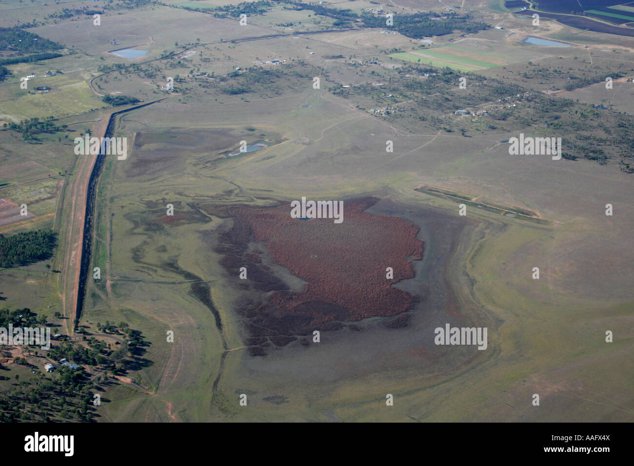
Atkinson Dam occupies most of the locality.
The northern boundary of the locality is marked by Buaraba Creek, a tributary of Lockyer Creek.
History
Atkinson's Lagoon Provisional School opened on 6 August 1885. On 1 January 1909, it was upgraded to a State School. It closed in 1968. It was located near the intersection of the south-west corner of the present Atkinsons Dam Road and Rocky Creek Road (27.4144°S 152.4300°E / -27.4144; 152.4300 (Atkinson's Lagoon State School (former))).
Demographics
In the 2016 census Atkinsons Dam had a population of 205 people.
In the 2021 census, Atkinsons Dam had a population of 191 people.
Education
There are no schools in Atkinsons Dam. The nearest government primary schools are Coominya State School in neighbouring Coominya to the north-east, Mount Tarampa State School in Mount Tarampa to the south-east, and Kentville State School in Kentville to the south. The nearest government secondary school is Lowood State High School in Lowood to the south-east.
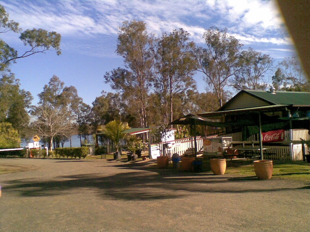
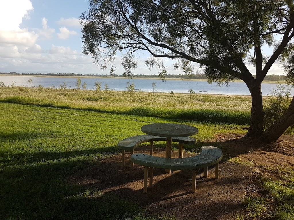
Amenities
Atkinson Dam Park is on the northern side of the Atkison Lagoon (27.4211°S 152.44966°E / -27.4211; 152.44966 (Atkinson Dam Park)). There is a boat ramp off Atkinson Dam Road into the lake (27.4206°S 152.4490°E / -27.4206; 152.4490 (Atkinson Dam Road boat ramp)), which is managed by the South East Queensland Water Corporation.
References
External links
Media related to Atkinson Dam at Wikimedia Commons